
Hot Air Balloon Marker Drop Assist
Small Vue.js web app to assist in marker drops during hot air balloon competitions, designed to work on mobile phones.
App requires GPS signal to work. Phone GPS accuracy is not good enough - I recommend connecting external bluetooth module such as Garmin GLO.
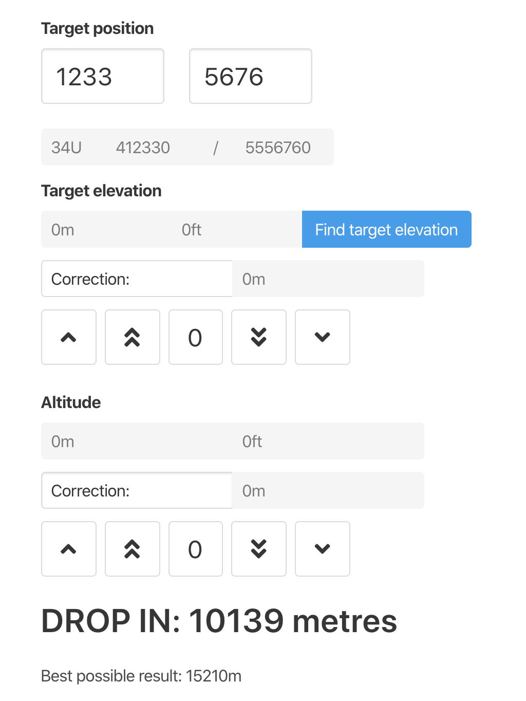
Enter target position from your task sheet. App retrieves full UTM coordinates, assuming that target is in the same UTM zone as yourself.
While navigating to target, app will calculate the closest point to target you can reach and tell you when to drop your marker (DROP IN reaches 0m) to land it on that point. Marker drop speed is set to 10m/s.
To properly calculate distance, it needs height difference between you and ground. You can find target elevation by clicking blue “Find target elevation” button. Data is taken from Mapbox Terrain-RGB global elevation map.
If you have more precise data on target elevation, you can use correction buttons to set real elevation.
You can also apply correction to reported altitude if for example your vario shows different altitude than unaccurate phone GPS.
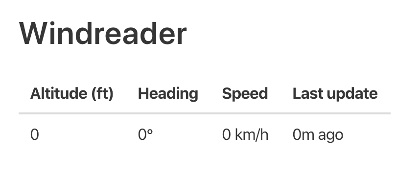
When you scroll down, you will see windreader reports. Windreader calculates average of 5 last readings on given altitude and shows them in table.
“Last update” will tell you the last received reading on that altitude, so you can be aware how old is your data.

